

Route Summary
 One of our longer walks, with an overall ascent of 528 m, offering marvellous open views, the route provides an excellent insight into the history of this still very productive area. The Cho Pancho recreational site provides the opportunity for a very pleasant mid-hike break.
Duration: 4.5 hours
Route Overview
Duration: 4.5 hours.
 Transport/Parking: Titsa 416 from Los Cristianos. On street near to start of walk.
Length: 9.570 km / 5.98 mi
Height Gain: 528 meter
Height Loss: 528 meter
Max Height: 634 meter
Min Height: 1110 meter
Surface: Rough. Very rough sections of old paths in places.
Child Friendly: Yes. But only if children are used to hikes of this distance on rough surfaces.
Difficulty: Moderate to hard.
Dog Friendly: Yes. On lead in El Roque and at Cho Pancho.
Refreshments: Bar Chachi in El Roque. Numerous options in San Miguel and San Lorenzo.
Description
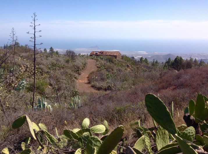 This walk is near to our limit of 10 km in length, and requires a gradual but unrelenting ascent from 634 m above sea level to 1,110 m. Leaving the quiet village of El Roque, the route soon starts to take an old stony camino uphill, eventually joining rough rural roads amongst many productive farm terraces. Looking back, there are great views of the ancient volcanic landscape of southern Tenerife, and of the imposing mass of Roque de Jama and Montaña Guaza in particular. Of course, the distant coastal resorts stand out too, especially Los Cristianos. Looking upwards, forests and mountains dominate the scene. Along the way, in this border territory between San Miguel, Arona, and Vilaflor, there are many examples of human construction and agricultural activity – buildings, paths, walls, stone ovens, terraces, irrigation channels and reservoirs. Cereals, legumes and prickly pear cacti used to be the main crops, but it’s very much potato and grape growing country these days. The recreational area at Monte Cho Pancho is set on a delightful pine-forested hillside and is a great spot for a mid-hike picnic. On the return route, on a rough and rocky old path, there are a number of interpretation boards providing interesting information about this historically important “middle-lands” (“Medianías”) area of the island.
Links:
Photos from walk
Download Route Guide (PDF with illustrated Waypoints)
Download GPX file (GPS Exchange Format)
Access Walk on Viewranger
Access Walk on Wikiloc
