
Ifonche Cairns Circular (Adeje)
Route Summary
 Walking amongst some beautiful scenery, this trail ascends from Ifonche through open pine forest and takes in a section of the Barranco del Rey before returning to the Ifonche starting point.
Duration: 4 hours
* N.B. This walk is over 10 km!
Route Overview
 Duration: About 4 hours.
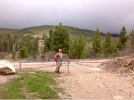
Transport/Parking: Car or taxi. Parking near Tasca Taguara, Ifonche area, opposite the Ermita.
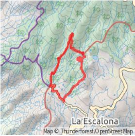
Length: 10.66 km / 6.66 mi
Height gain: 598 meter
Height loss: 598 meter
Max Height: 1391 meter
Min Height: 1000 meter
Surface: Average
Child Friendly: Yes, if used to ascent and distance.
Difficulty: Medium
Dog Friendly: Yes
Refreshments: Closest, Tasca Taguaro, or El Dornajo near the end of the route.
Description
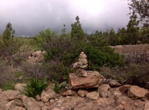 Walking amongst some beautiful scenery, this trail at first ascends from near to the Tasca Taguara, Ifonche through open pine forest using a very indistinct path which is, however, extensively marked by stone cairns. Vineyards and other agricultural terraces are passed before the route returns into the pine forest, joining the GR-131 path network. It then descends into a section of the Barranco del Rey, and reaches its highest point after climbing out of the Barranco. The trail becomes a ridge between the del Rey and del Infierno barrancos before descending to the El Dornajo restaurant in the centre of Ifonche. To return to our starting point at the Ifonche Ermita we walk along the quiet tarred road. N.B. this walk is just over 10km.
A SIGNIFICANT SECTION OF THIS WALK INVOLVES FOLLOWING AN INDISTINCT PATH, ALTHOUGH IT IS WELL GUIDED BY NUMEROUS CAIRNS. IT IS ESSENTIAL YOU TAKE THE CORRECT TURN-OFF (WAYPOINT #4) TO FIND THIS INDISTINCT PATH AND FAITHFULLY FOLLOW THE CAIRNS FOR YOUR MAIN ASCENT! DO NOT WORRY, THE CAIRNS ARE EASY TO SEE AND FOLLOW ONCE YOU ARE ON THE CORRECT PATH!
N.B. Thanks to the Tenerife Rambler for providing the model for this walk on Wikiloc.
Links:
Photos from walk
Download GPX file (GPS Exchange Format)
Download Route Guide PDF (with illustrated Waypoints)
Access Walk on Viewranger
Access Walk on Wikiloc
